TROLLER'S GILL
Up close and personal with Troller’s Gill - an 8 mile circle walk in Lower Wharfedale

Tucked deep in the quiet low folds of the Yorkshire Dales is the marvellous Troller’s Gill. This narrow limestone gorge is made distinctive by its dramatic steep walls and eerie confines, which have inspired legend for over 1000 years.
Although typical of the local geology, Troller’s Gill’s uncanny ambiance puts it in a league of its own.
Our walk begins in the quaint village of Burnsall before a succession of Wharfe-side paths take walkers into the mouth of the gill, via peaceful Skyreholme. An open-sky track makes for a kind and gradual descent into Burnsall.
There is also a wet weather alternative that runs parallel to the flood-prone ravine.
THE WALK
Start to finish: Burnsall (SE031610)
Map: Explorer OL2 (Yorkshire Dales Southern and Western areas)
Distance: 8 miles
Time: 3.5hr
Ascent/descent: 310m
Terrain: Gentle riverside path and upland trod. Trollers Gill can be a challenging climb.
Parking: Burnsall National Trust car park
Facilities/toilets: The Red Lion, Burnsall and tea room at Parcevall Hall Gardens
Fun fact: Troller’s Gill means troll’s a*se
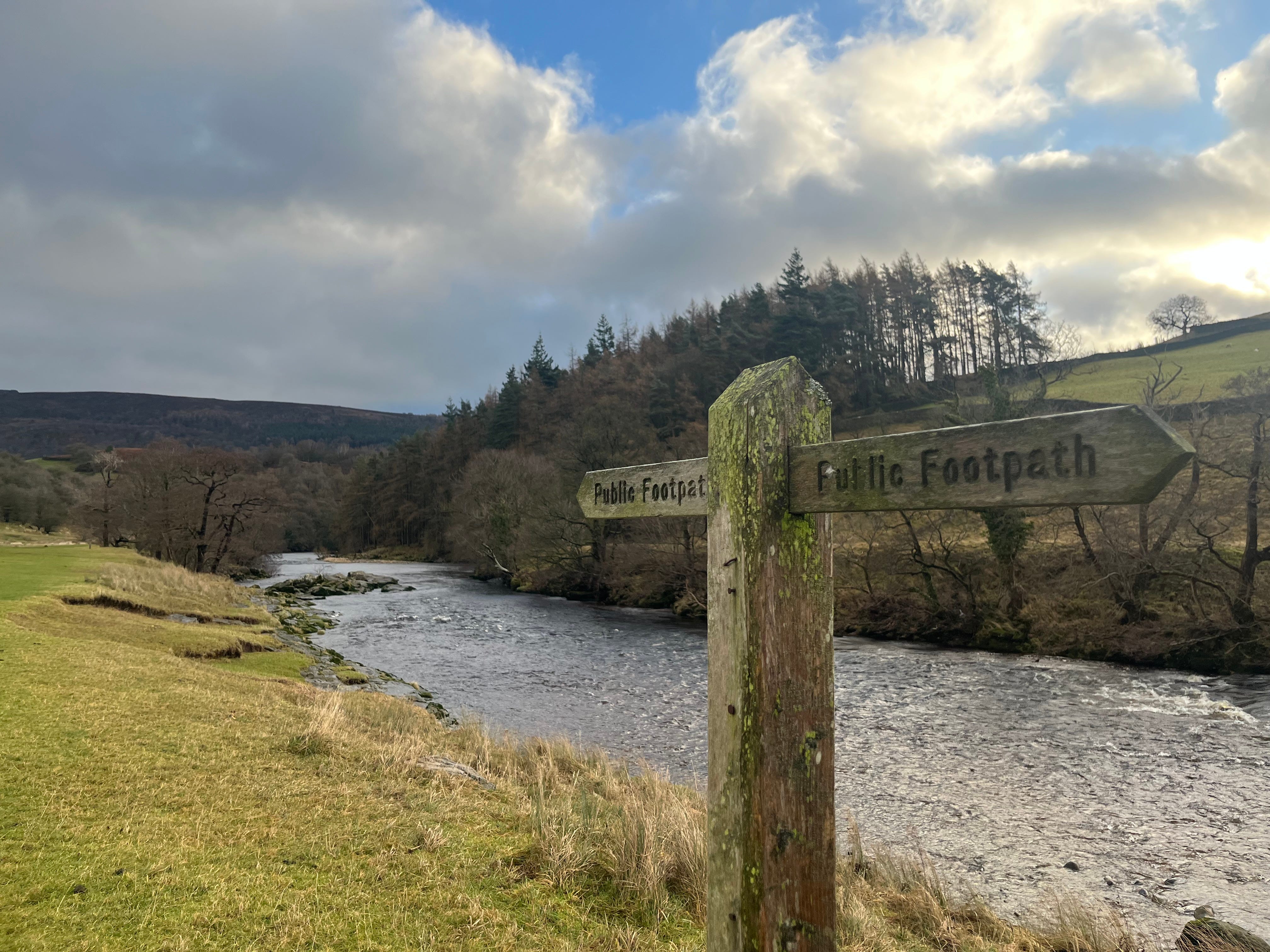
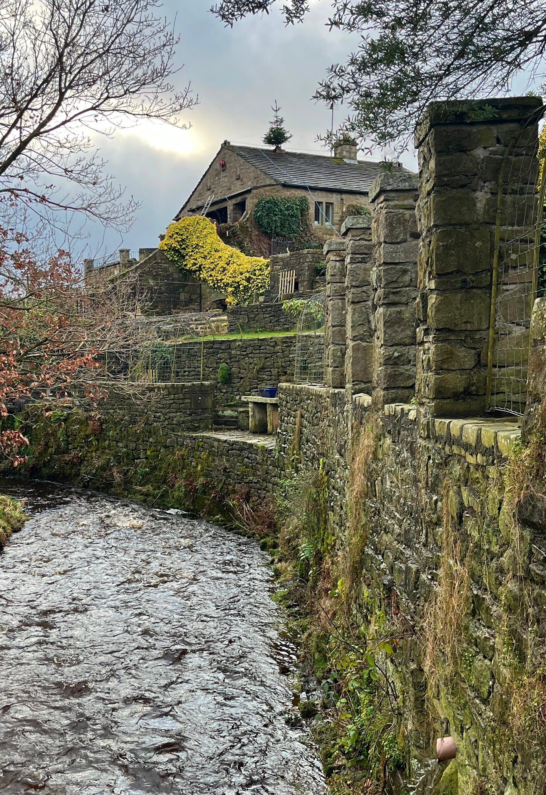
1. From the Red Lion pub, cross Burnsall’s broad stone bridge over the Wharfe. Dales Way signs to Appletreewick guide walkers down a stretch of riverside trod before the flow meanders away. A small wooden bridge at Barben Beck leads into a quaint courtyard at Woodhouse Farm.
Regain the river by keeping ahead through the yard and passing a caravan site below Appletreewick village. Follow a tidy grassy plot that runs parallel to the Wharfe. As a wooded valley briefly narrows, the river swirls over a rocky bed, its foamy flow tanned a peaty brown as it churns between the moss-clad stones.
Entering a rough meadow, cut left to Fir Beck and shadow it up an enclosed wooded glen before emerging onto a road by another bridge. Cross and immediately turn left onto a path rising to Howgill Lane.
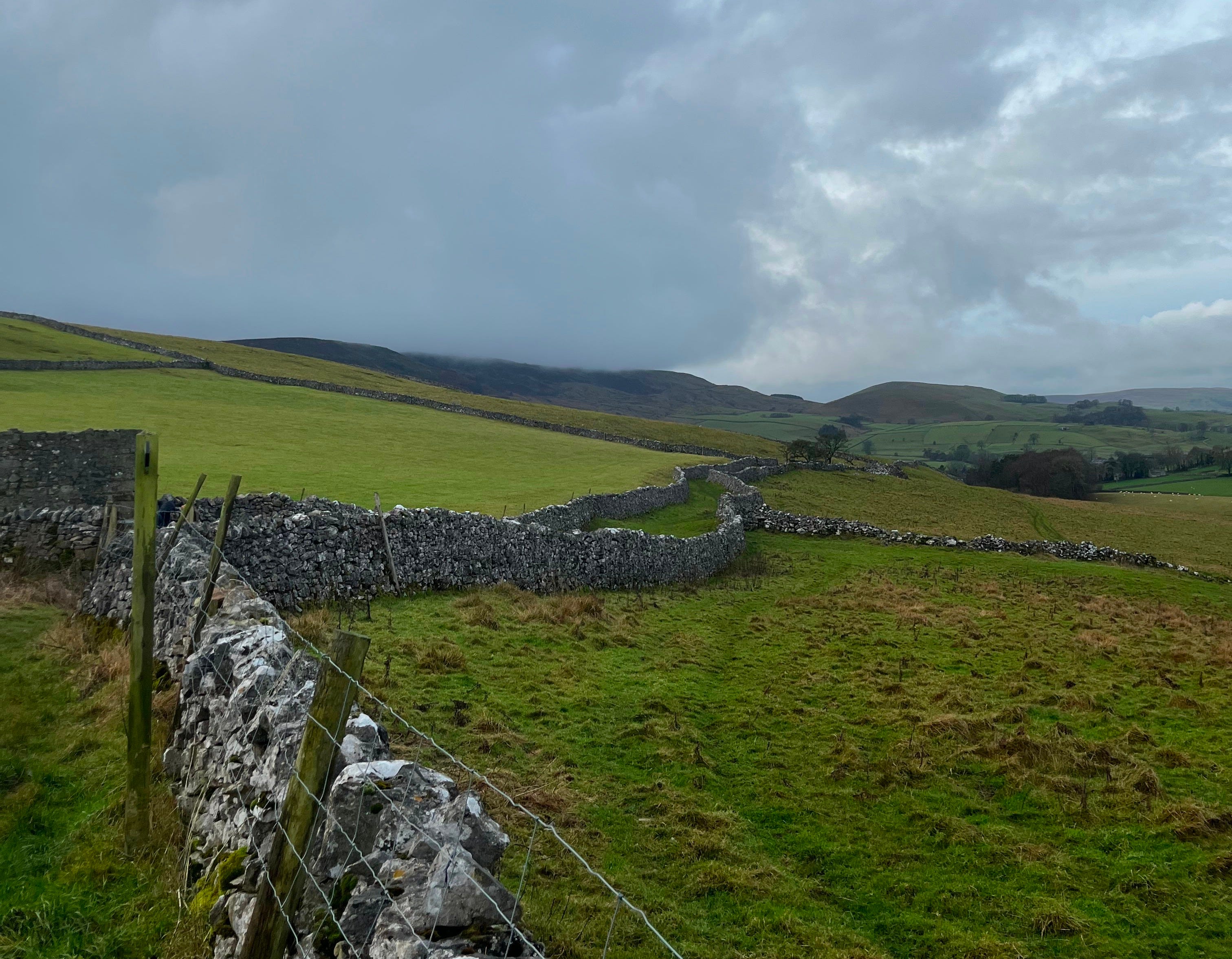
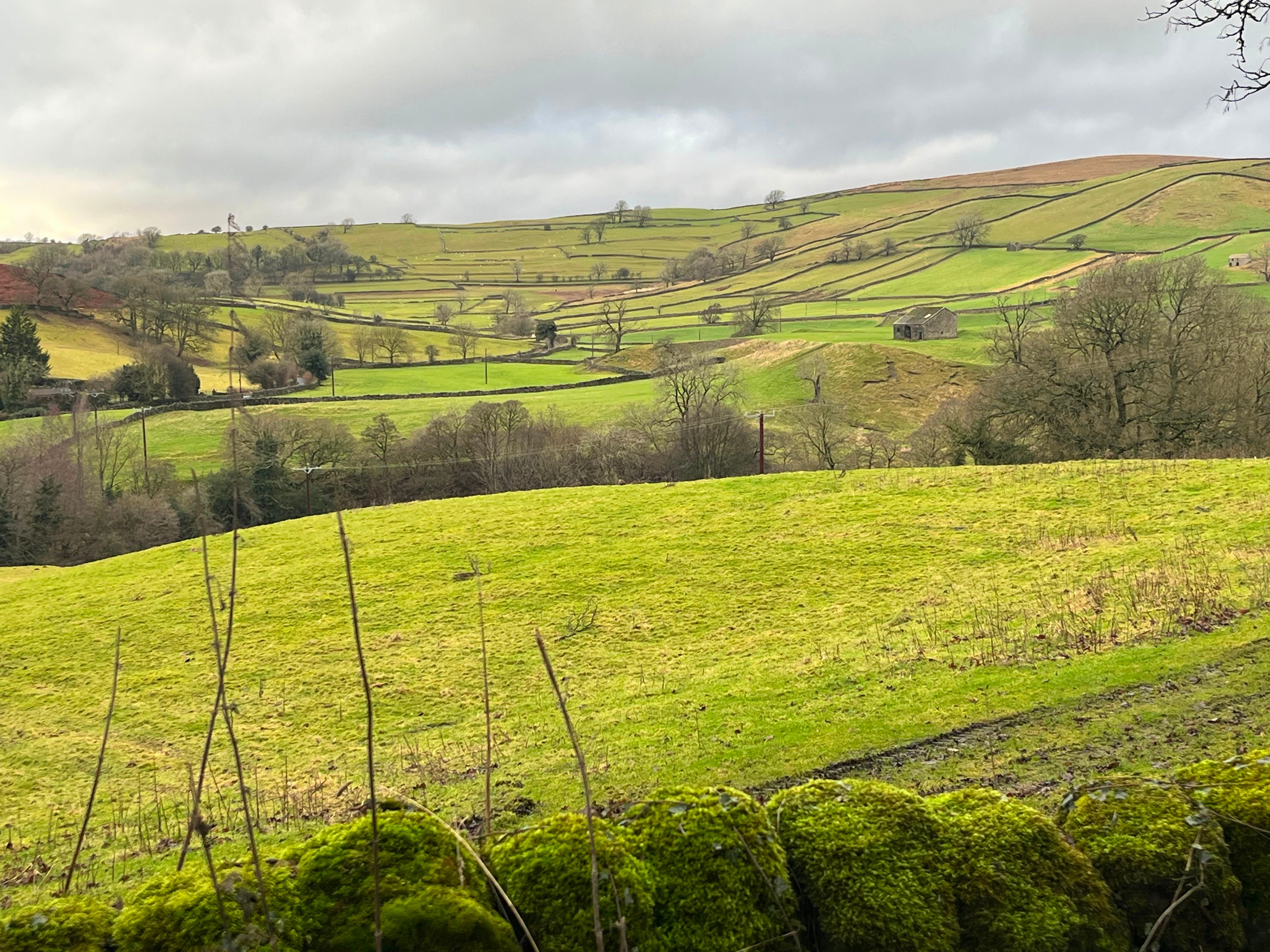
After reaching a crossroads, turn left again to head up the valley. Looking left, walkers can pause to enjoy the views across the terraces. An emerald green hillside contoured with dry stone walls is quintessential Yorkshire Dales.
Just beyond a converted barn and a no-entry sign, leave the lane through a gate on the left, from which a grass track slopes across more terraces down to the secluded village of Skyreholme. Gradually descending through field after field, the way leads up to a bridge that crosses a beck at the rear of the village.
Climb between Skyreholme’s mossy brick walls before reaching a lane that takes you towards a fork in the road leading to Parcevall Hall. Before reaching the hall, leave the tarmac by a small bridge where a field track is signed off before Skyreholme Beck to New Road. Craggy hilltops overhead give an ominous feel on the approach to the gill.
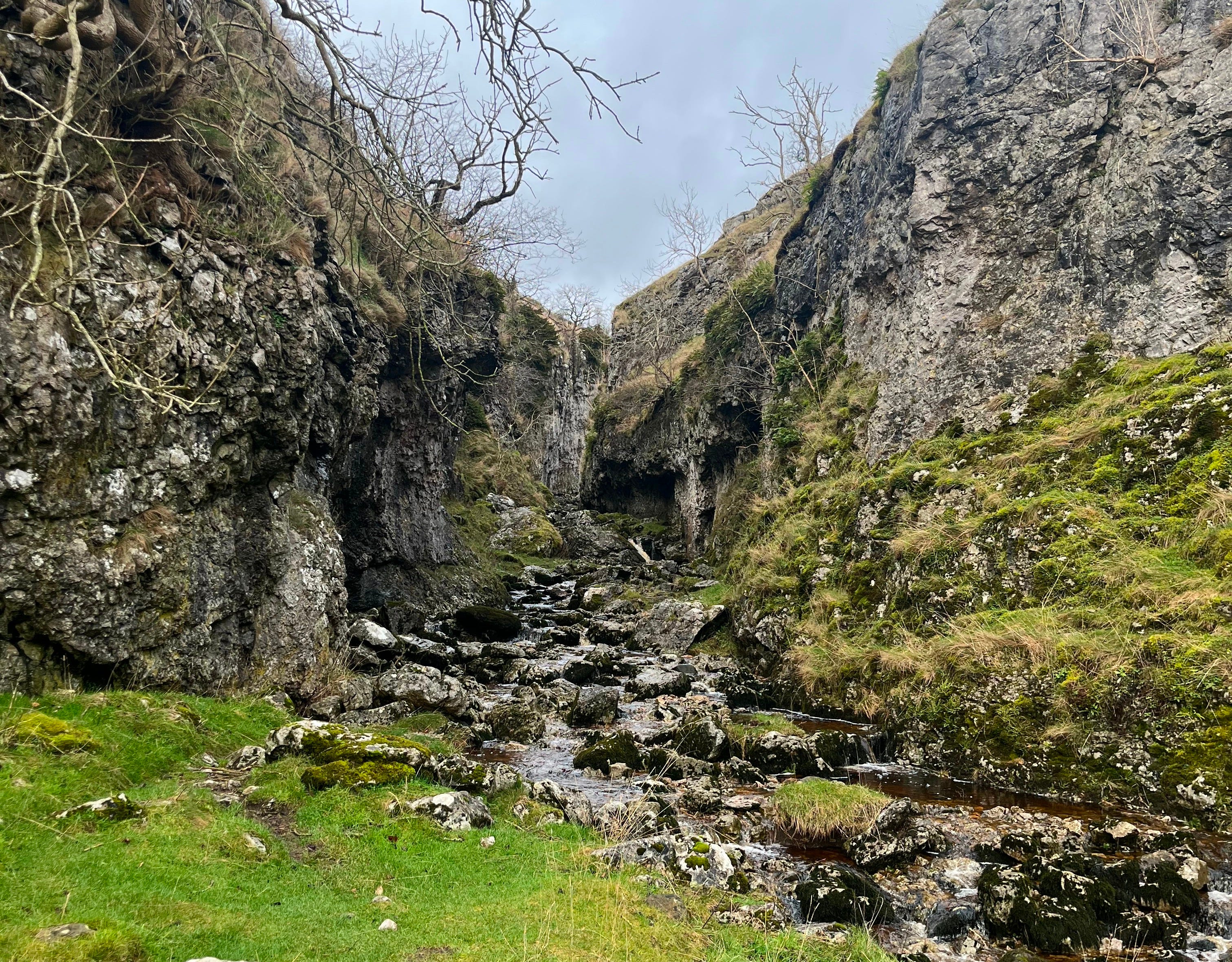
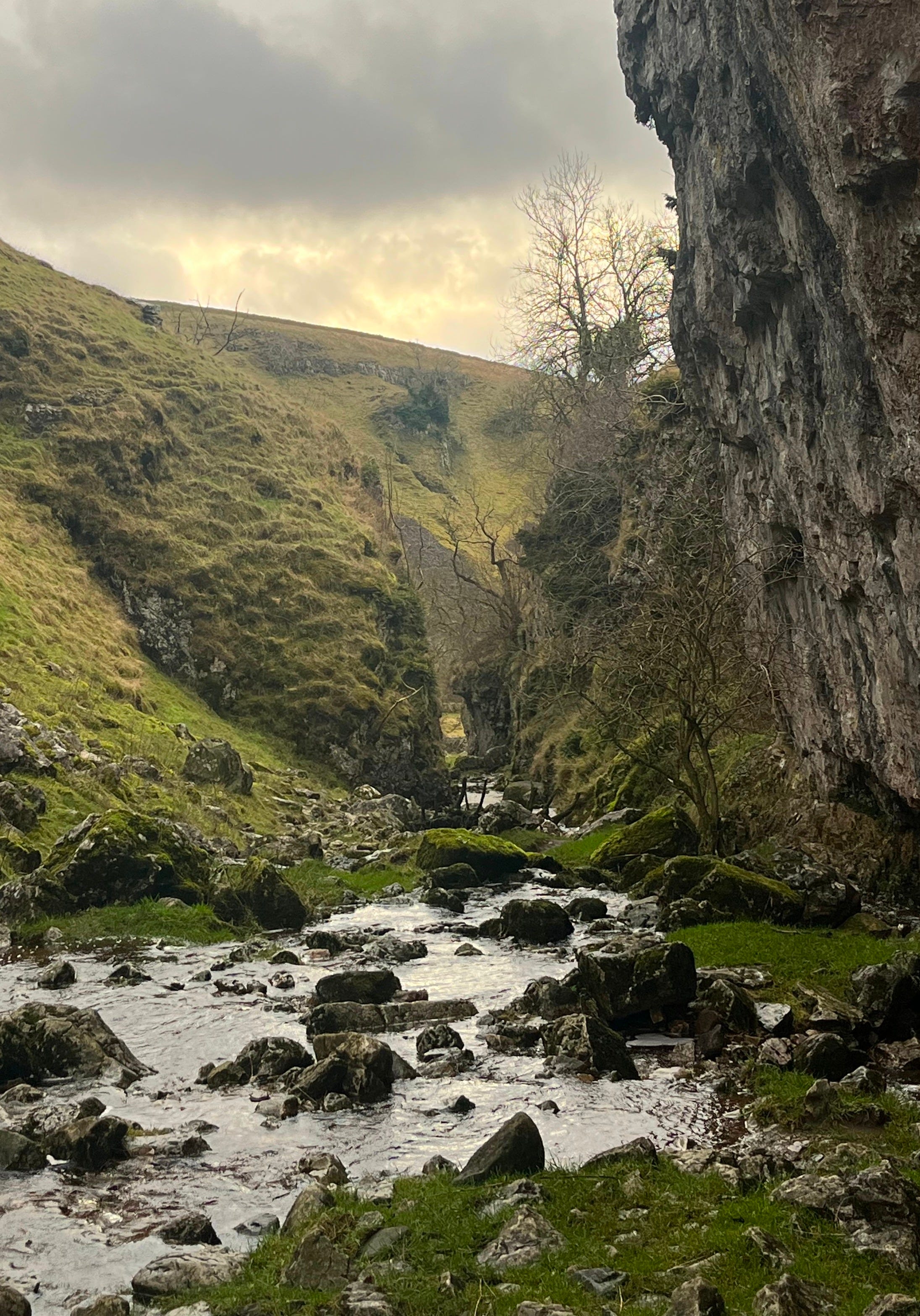
2. Passing over a ladder stile, the way winds behind the site of an abandoned dam into the upper valley. There is a sudden change in scenery as walkers gradually ascend the limestone surround. Often richly veined with ores, the limestone in this area is no different, with the remains of an abandoned lead mine visible from the pathside.
Further up the secluded valley and over another stile, the path splits, the right branch tracing the course of a stream round to Troller’s Gill. Observant hikers will note resurgent streams bubbling mysteriously out from the earth. Except in times of flood, it goes underground higher up the valley, leaving the intervening stream bed quite dry.
Braving the stream is the only way up the ravine, but the dark overhanging cliffs either side heighten a sense of adventure as walkers scramble over dry-pools and small falls. Water plants drape over stone slabs and wisps of moss sprout from cracks in the walls, adding a supernatural feel.
The name Troller’s Gill refers to local legend. Goblins were said to throw rocks down at passersby or lure unwary travellers into their hidden caves. Other strange tales mention a Barguest, a terrifying spectral hound with a black coat, razor teeth, and fiery red eyes. One story tells of a wandering preacher who, armed only with protective charms, ventured into the gorge late at night to confront the beast. When daylight came, all that could be recovered was his mutilated corpse.
* If Troller’s Gill is flooded, return to the last junction and follow the main track up the adjacent valley to Gill Heads.
Shortly into the clamber, the enclosing walls break away slightly to reveal steep, grassy banks as you climb out past an adit, a horizontal mine entrance. As the walls divide, a path becomes discernible from the wet rocky slope, albeit occasionally hopping from one side to the other. Endeavour onwards past the spot where the stream sinks underground and mount a stile over a wall on the far bank.
3. Cross the stream at the next opportunity, which is a small wooden bridge leading onto a zig-zag track over the hilltops towards New Road. Maintaining high ground, follow the grit track right before immediately ascending left onto a track newly refurbished with stone slabs. From these high points, the broad top of Buckden Pike can be noted. On reaching New Road, follow it south before turning right onto a bridleway signposted to Hartlington.
Whilst this stretch is on the anticlimactic side to begin with, the dipping path on the other side of a slight hill crest offers magnificent views into Wharfedale. Carry on through farm gates, eventually swinging right at a fork. The way shortly crosses a path between Appletreewick and Dibble’s Bridge before winding down between the lower fields, ultimately meeting a lane.
Take the track opposite towards the Dales Way. Back at Woodhouse Farm, swing right across the footbridge at Barben Beck and retrace your steps back to Burnsall via familiar riverside paths.