
ON TOP OF THE WORLD
Oop in’t Oughtershaw, Yorkshire's answer to the Scottish Highlands

The exact source of the Wharfe is a challenging find. Streams that flow east to form the river are wrung out from peaty bogs high up in the Pennines. Somewhere within the enclosed glen of Oughtershaw Beck, ooze turns into flow, and the river is born.
This walk follows said beck to the watershed before climbing up to Cam High Road for a leisurely plod along an ancient track beneath Dodd Fell.
This walk is best preserved for a fine day to help savour the subtle beauty of this forgotten mountain fold.
DEAR DIARY…
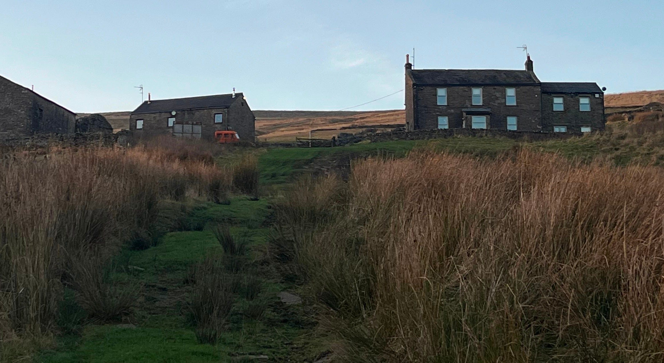
“It was mid-March, and I was trudging along a pleasant roadside towards Oughtershaw. Being but a string of cottages gathered by one arterial lane, the village would, unfortunately, not be my evening halt.
It was a sign, however, that virtually all of the day’s ascent was now behind me.
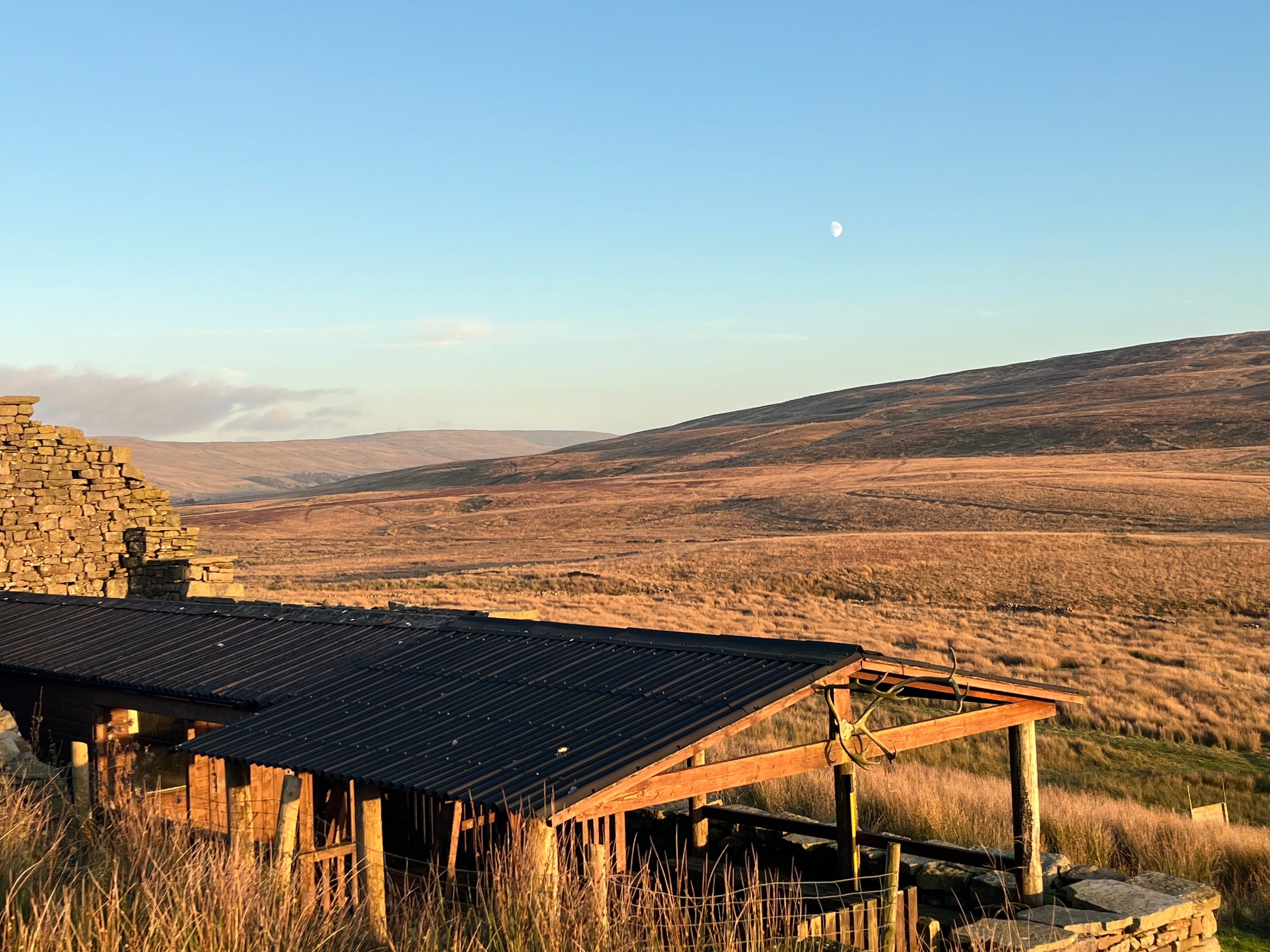
I got my map out at the next available seat; on this occasion, the window of a derelict barn. Down the valley, the river Wharfe had now disappeared in the folds of Langstrathdale Chase. I was quite high up now. I was on a level with, if not higher than, many of the hills around me. And after a day of walking, I felt on top of the world.
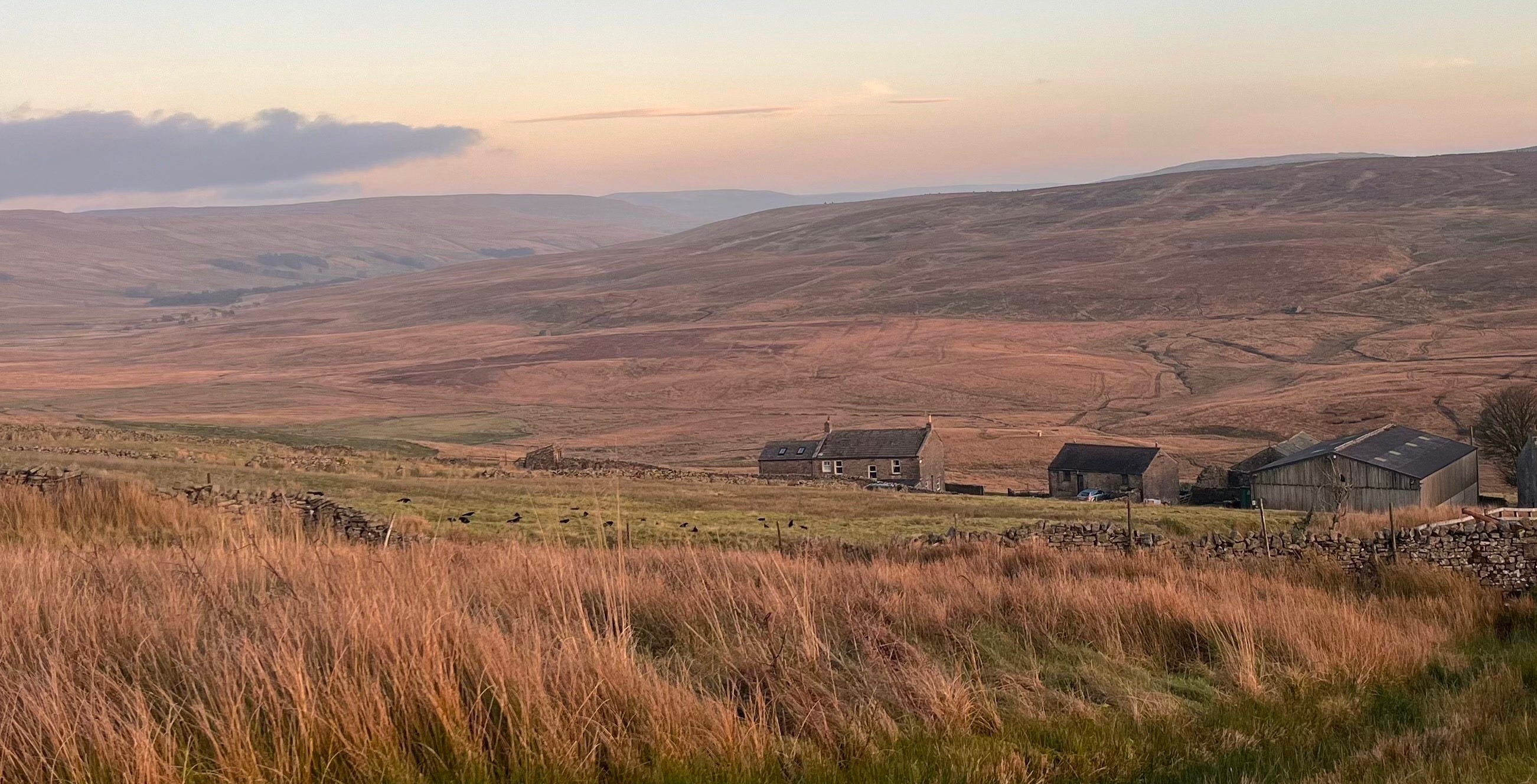
Working from my map, I was about 3 miles away from my evening rest, a camping plot at Swarthgill Farm. The weather was agreeable, and there was plenty of daylight left, so I continued in high spirits.
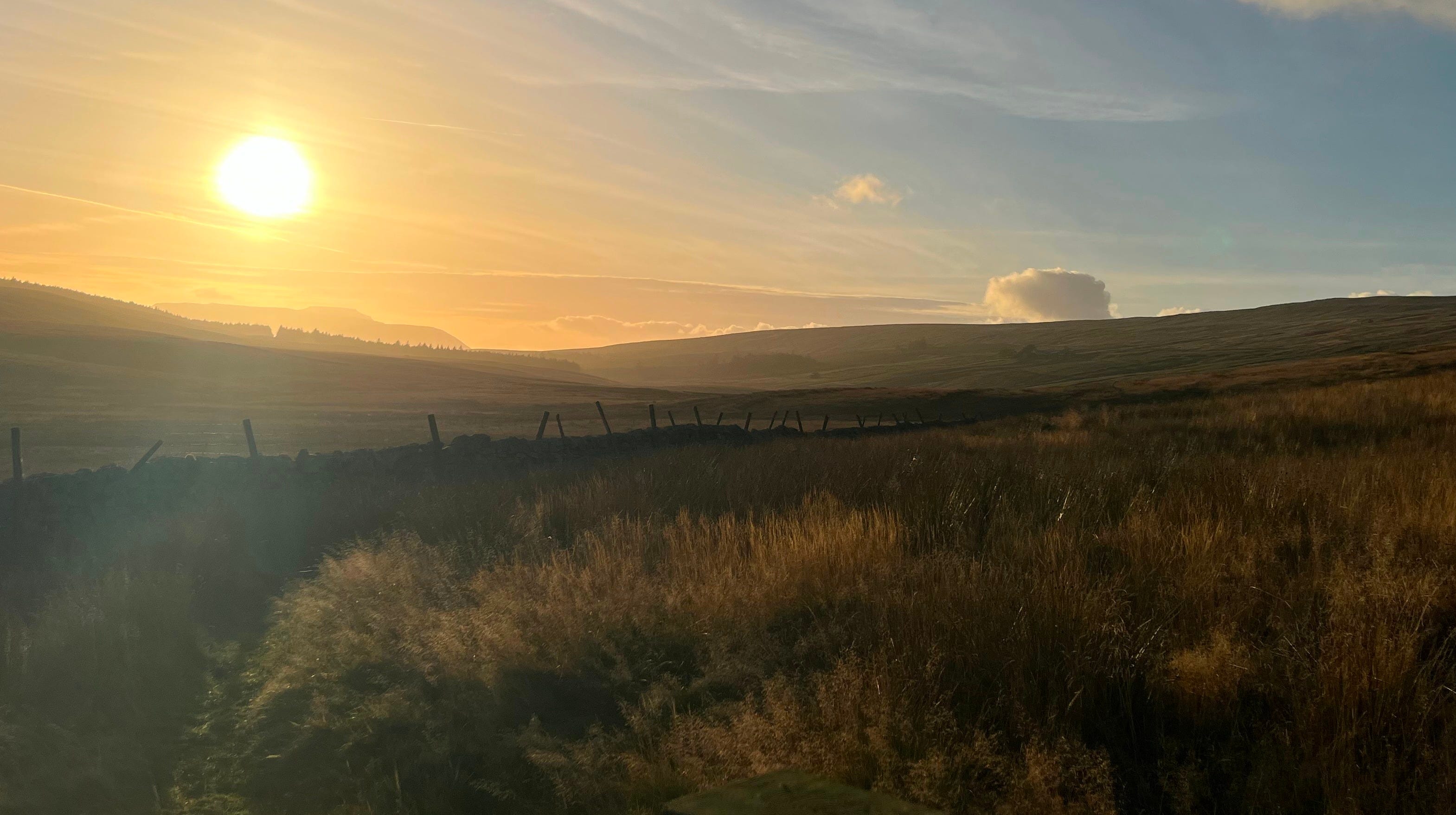
By the time I left Oughtershaw, via a path up the glen, light had settled on the hillside, creating a striking sun-bleached scene. The warm flood at the far tip of the valley was enticing.
Squinting, I could also make out Swarthgill glistening in the auburn heather.
The mossy ground was pleasing underfoot, and the way was lined with columns of young trees, who played host to dozens of singing garden birds.
On arriving, I hobbled through the courtyard of Swarthgill looking for someone to pay or some way of indicating my interest in staying the night. Half an hour of me awkwardly trying to make eye contact with people inside the building passed.
Exhausted and now genuinely concerned I was in the wrong place and scaring some innocent family with my desperate vagrant act, I plucked up enough courage to call out for someone.
A man about my age (you can never tell with farmers) came out to greet me. He appeared befuddled by my being there even when I explained to him that I wanted to use his camping plot.
I was then taken to a slanted patch of earth littered with bricks. I was assured that the state of the patch was temporary and doubly assured that it is a popular plot for walkers. As it started to rain, I handed the man a tenner, and off he scurried.
As night fell, I went into a utility room with showers and a microwave. It was warm, dry, and the floor was flat. I sat there with my chicken & white wine sauce in my sleeping bag. Before falling asleep on the floor between the shower and the toilet.
Five stars.”
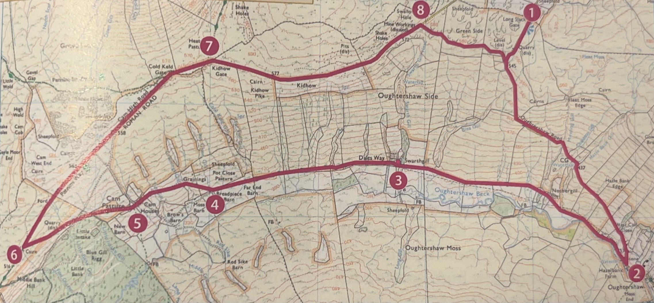
Start to finish: Long Slack Gate on Oughtershaw Road
Map reference: (SD 868815)
Distance: 9 miles
Time: 3.5hr
Ascent: 340m
Terrain: Rough moorland trod and tarmac track
Parking: Oughtershaw village roadside
Facilities/toilets: Hot/cold drinks may be available at Nethergill Farm
1.Head south down Oughtershaw Road over the crest of the hill, following the winding tarmac road down to the bottom of the valley. As you descend, the meat and drink of the walk is laid out to your right.
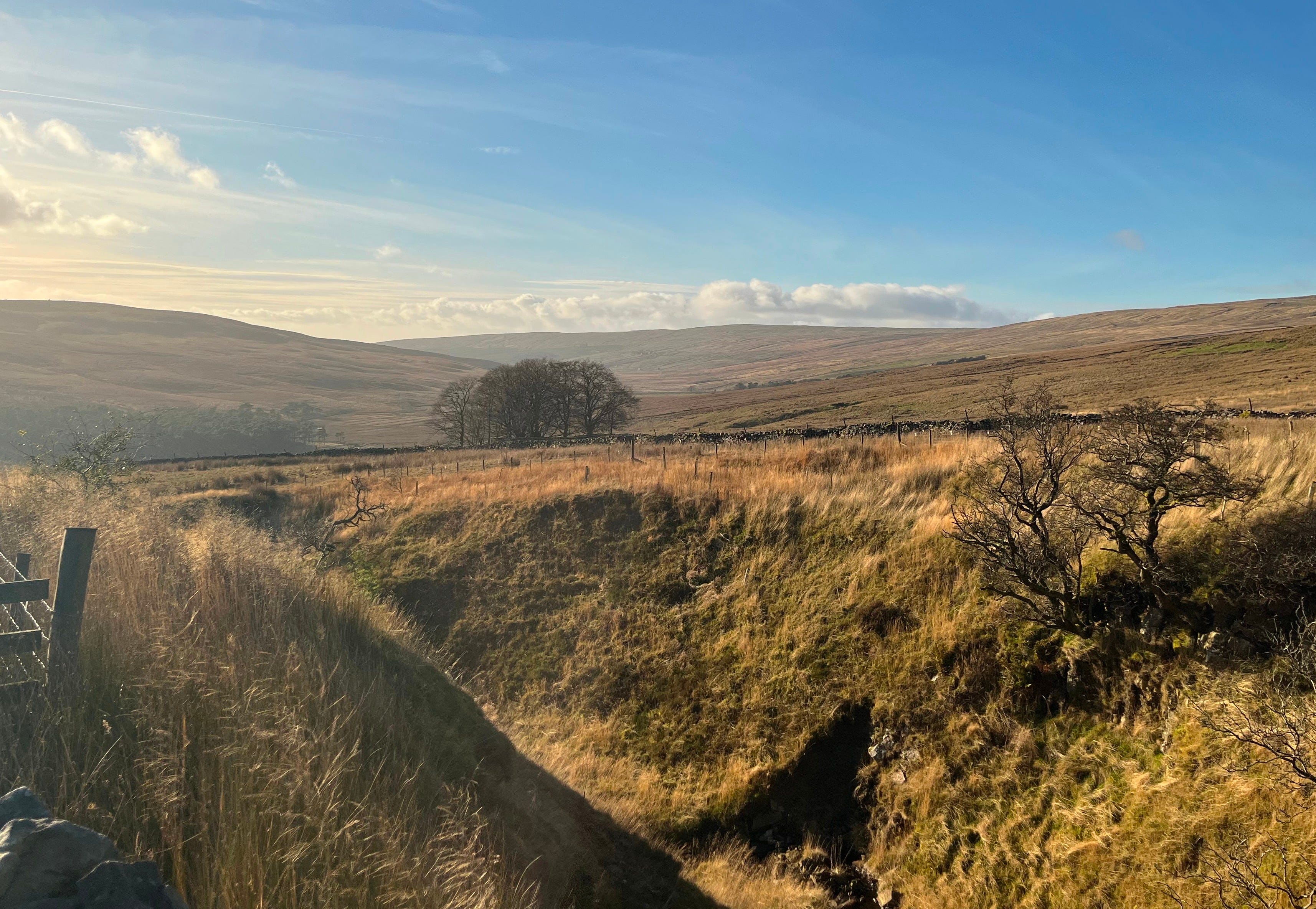
The view of Oughtershaw has a charming isolation to it. The flat wilds, reminiscent of the Scottish Highlands, create a bracing remoteness, a living stillness only nature can conjure.
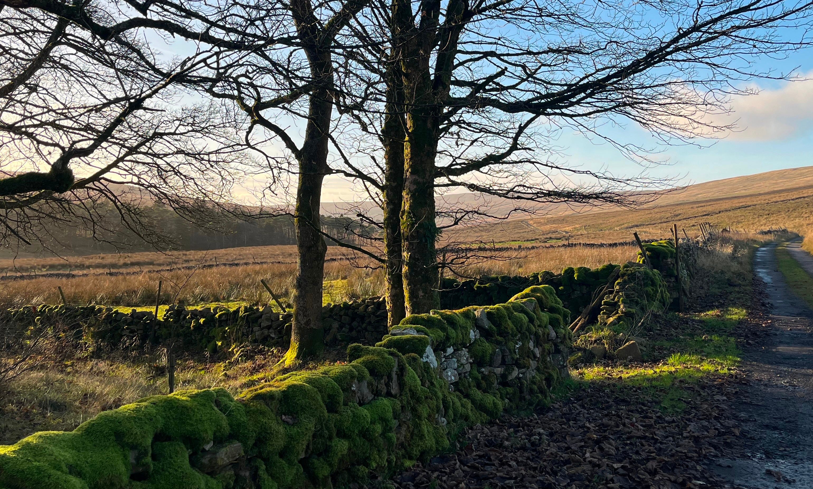
As the lane levels out at the village of Oughtershaw, past a small barn, turn into the glen at a sign marked for the Dales Way.
A well-kept track rolls up the valley beside a peaty beck, which lightly trickles over an endless succession of shallow stone slabs.
Keep walking past Nethergill Farm (where accommodation and refreshments may be served) to the end of a track at Swarthgill Farm, a lonely farmstead unattached to the rest of the barren valley. Way marks take you past the main farmhouse to a small gate.
Towards the head of the valley, beyond a stretch of bare moorland slopes lies a distant forest plantation. Much of the walk is bristled with woodland regeneration projects, with which comes a dappling of garden bird species who flutter overhead.
The view down the valley is desolate but not deserted, for there is one more farm high on the hillside ahead.
2. A solid path leads you to the edge of consecutive enclosures. The Oughtershaw basin is spongey and prone to becoming waterlogged. It is wise to bring appropriate footwear for these conditions.
After three quarters of a mile, the boundary switches to run along the other side of the path and guides you past an isolated field barn to a second laithe, Breadpiece Barn. On your approach, a sign directs you to a small gate on the right to pass behind it, striking a now diagonal ascent up the hillside to a second stile.
Continue gaining height across the intervening enclosures to the peculiar Cam Pastures. There is something so uniquely Yorkshire Dales about Cam Pastures. The rugged, functional buildings, which sit atop a slight incline, have assimilated into the Pennine gloom. The elementary row of houses has a tragic practicality to it.
A bitter efficiency that one will struggle to find in other national parks across the North. Cam Pastures was meant to endure, not dazzle.
3. Walk past the first farmhouse and then swing right and left, following Dales Way signs through the farm. Ignore a steep track away and instead curve left past another cottage and barn, passing through a few gates onto the open moor beyond. Slant up the hill, aiming just short of the upper tip of Cam Woods, before mounting a stile to cut off the corner of the plantation.
Once emerging onto a track, cross to the path, which ascends diagonally left. Join a fence at the top and follow it left to yet another stile, where Cam Woodlands and a cluster of drumlins fall away to the west. Despite not having much to climb, there is a powerful sense of being on top of the world.
Over the fence, the path continues up to Cam High Road. The way, laid out across the empty moor by the Romans in the first century, served as a crucial link between the forts at Bainbridge, Ribchester, and Lancaster. It later became an artery used by medieval wool traders.
The roadside return is to the right along the Pennine Way. The path is now much kinder underfoot than the mire of the glen. The well-paved track is roughly metalled, which helps with adhesion on the ground but in no way distracts from the open beauty of the scenery that surrounds.
Approaching the snout of Dodd Fell Hill at Kidhow Gate, the Pennine Way branches off left to Hawes. Walkers can now get a picture of how high up they are, as Hawes twinkles a considerable distance down in Wensleydale’s valley floor. You, however, must take the path forking left across a cow grid, which traces the southern flank of the hill above Oughtershaw Side.
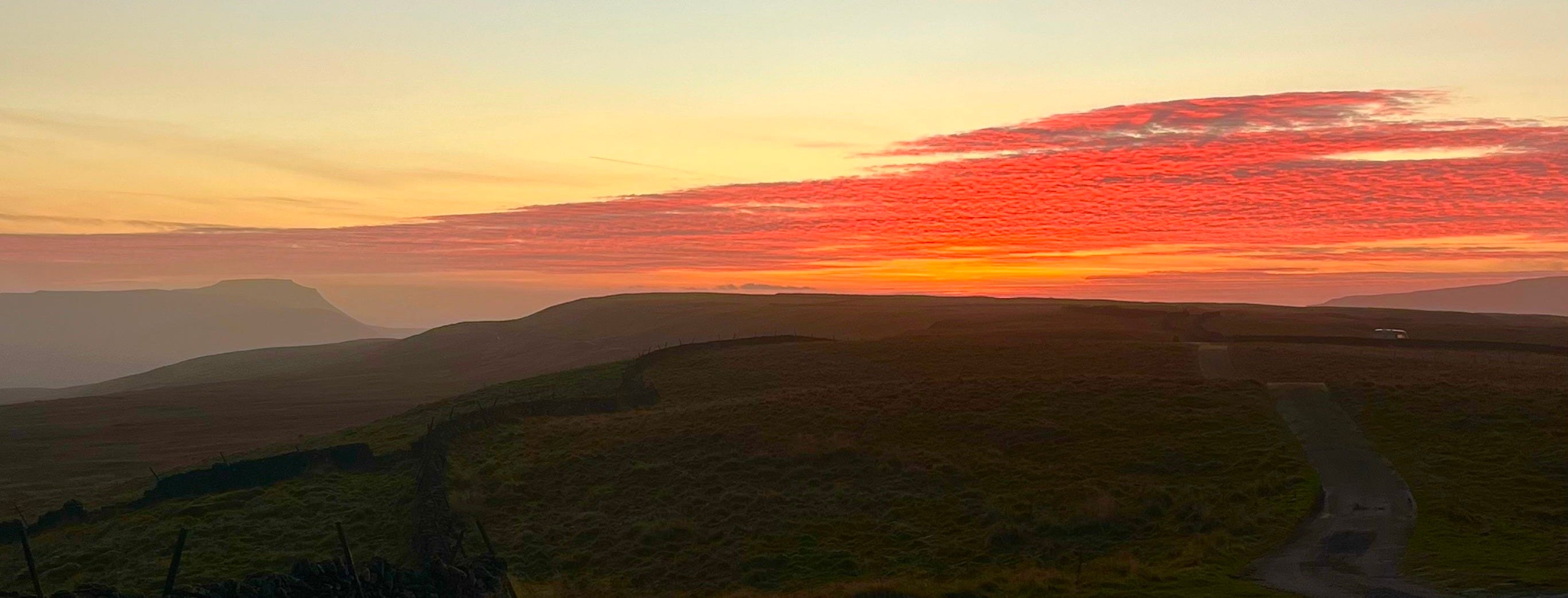
At this point, look over your shoulder at Inglebrough. Though visible for much of the walk, here, the mountain’s strikingly carved top is etched into the horizon.
After a medium stretch of one and a quarter miles, passing above the landmarks from earlier in the walk, keep your eyes peeled for a trod leaving by a small cairn across the moor to the right.
As it becomes more distinct, the way contours above the slope, soon leading to a large stile and gate in a crossing wall. Push onwards, later passing a second gate and ultimately returning to Oughtershaw Road.
If you miss the somewhat concealed moor trod, the ongoing track does join onto Oughtershaw Road slightly further past the car park. Simply follow it back to Long Slack Gate.
Your reward on completion? An exquisite mountain panorama by the car.
You breathe life and humour into remoteness.